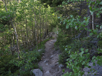
On this run at St. Vrain Mountain, I did take it easy, hiked the uphills and lollygagged with the camera quite a bit, but I ran the flats, low grades and downhills. It was a "restful" medium trail run day in the high country.
The mountain itself is unspectular as mountains go, but it was the journey that counted.
The trail slowy ascends out of the pine forest, teasing with ever-more-open views, topping out on a ridge that certainly deserves the title "pass" even though it has no name. Views of Longs, Meeker, and all the peaks of Wild Basin open up before you.
The summit is about 45 minutes of boulder-hopping from that view.
Once on top, I said a quick "Hi" to the folks lounging in the rock shelters, looked around, and on a whim started down the other side to have a look. I spotted what I'd later find out was Pear Lake, and reckoned I could run along the ridge and maybe reach a lake in one of the alpine bowls below. I started down.
It took longer than I thought, partly because the terrain was rugged and footing was tough along the ridge. I ran nearly two more miles before realizing I needed to turn back. However, I did get some closer views of Elk Tooth.
The going was even tougher headed up, but the feeling of being in such an amazing place, high on the amazing sights around me and at my feet, was fantastic.
Wildflowers seem to come in all sizes up there, as long as it's "small".
A peek at Paiute Peak (center, with the notch in it). It's worth zooming in.
After several hours of running on rugged surfaces, I was feeling some fatigue. This trail, like many in the Indian Peaks, is unrelentingly technical, requiring constant concentration. There were very few stretches where I could acquire some momentum and take more than one or two strides without changing rhythm or without landing on a slant or on top of a small, teetering rock. You really learn to finesse your landing and foot placement on trails like this.
Here, snow melt follows the trail, turning it into a creek. Want dry feet? Prepare to dance.
One of the smoother sections:
And finally on the last 1/2 mile, the surface smoothed out a little:
I actually refilled my bottle in the car and ran up again, just so I could run that last part twice. Finally, something smooth.
Distance was 14.18 miles, time 6:07 (moving 3:59), elevation gain/loss 4,548 feet, avg. pace 25:56 (moving 16:55), and best pace 6:46.


